Catalog number:
2012.17.2
Object Name:
Mining
Date:
1904
Search Terms:
Priest Lake Mining Company
Continental Mine
Cedar Creek drainage
Gold Creed drainage
railroad surveys
wagon roads
water right survey
Priest Lake
mining claims
mining sites
Continental Mine
Cedar Creek drainage
Gold Creed drainage
railroad surveys
wagon roads
water right survey
Priest Lake
mining claims
mining sites
People:
William Burk
John Hearding
Burk, William
John Hearding
Burk, William
Description:
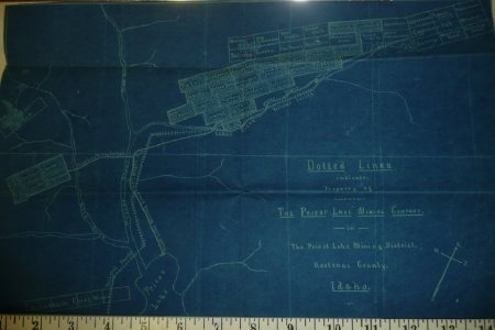
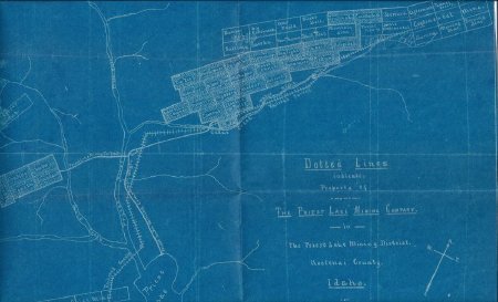
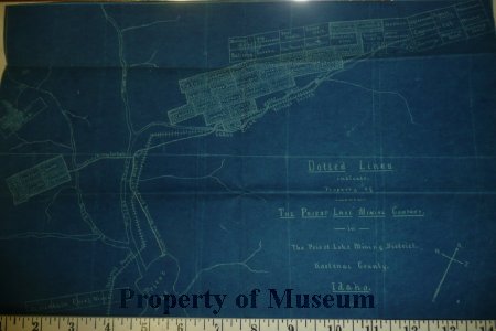
Object is a blueprint map of the Priest Lake Mining Company properties that accompanied the William Burk letters to John Hearding. In 1904 this land was part of Kootenai County.
Located and named are numerous claim sites within the Gold Creek and Cedar Creek drainages. Included are trails, wagon roads and railroad survey locations.
Located and named are numerous claim sites within the Gold Creek and Cedar Creek drainages. Included are trails, wagon roads and railroad survey locations.
Click to Enlarge
 Map of Priest Lake Mining Company properties
 Tom Thumb mine map
 Map of Priest Lake Mining Company properties
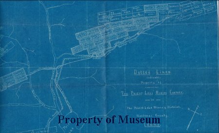 Tom Thumb mine map